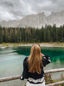
South of Iceland in 7 Days
Every day, there is an adventure waiting to happen in Iceland. With it’s abundance of mountains, volcanoes, glaciers, rivers, lakes, caves and otherwise rough terrain waiting to be tackled, Iceland is truly and outdoor enthusiast’s paradise. I could rave all day about Iceland, its natural wonders are truly something to behold. So there we went, after months of talking about it! We booked the trip and took a flight to Iceland. Together with 4 friends, I embarked on the journey of a lifetime!
Introducing Iceland
Iceland was found more than 1.000 years ago during the Viking age of exploration. It has a settelment of a mixed Norse and Celtic population. The early settlement was made up primarily of Norwegian seafarers and adventurers. Nowadays the country has only 300.000 people. Iceland has the atmosphere of a small town, but there is a lot to do for tourists. Iceland is typically divided into seven different geographical regions. Each region differs slightly regarding culture and landscapes, but all are uniquely Icelandic. The regions are South Iceland, East Iceland, North Iceland, the Westfjords, West Iceland, Reykjanes, and Reykjavík capital area.
Since it is our first visit to Iceland, we thought long and hard about what we wanted from this trip. There are many amazing roadtrip routes to be found online. Depending on the season, the amount of days, are you self-driving or partaking in a pre-organised trip, there is something for everyone. The most popular route is the South Iceland Route. Travelling along the marvellous Southern coast of Iceland, this route encompasses many of the nation’s most famous sights. But it doesn’t require you to spend huge stretches of your day in the car.
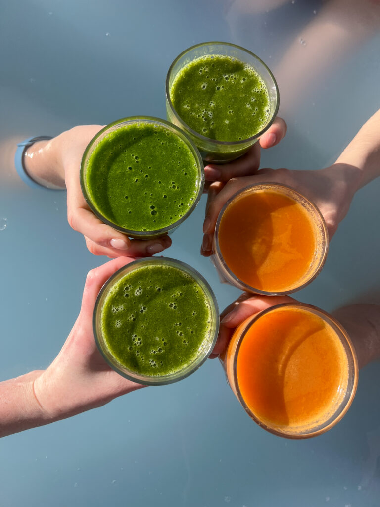
So get ready to rev your engines, adjust your seats, and assemble your favourite road trip snacks. Here is the road trip we made in Iceland.
Day 1
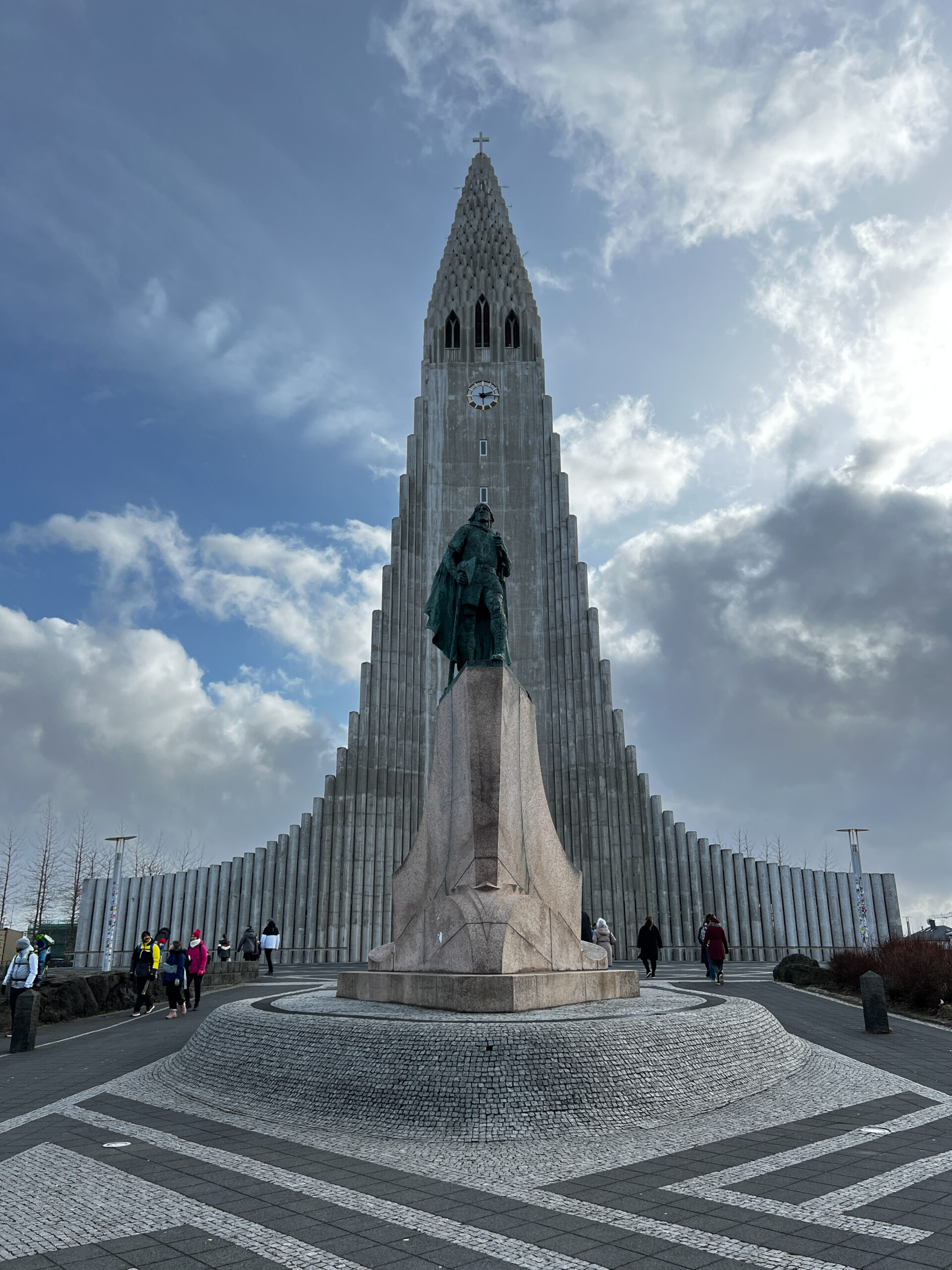
Flying into Keflavík airport, here we started the journey. So after picking up the bags and getting our rental car we set off to our first accomodation. Hotel Viking is a 35 minute drive from the airport and after dropping off the luggage we explored Reykjavik. Iceland’s capital and the nation’s centre for arts, culture, shopping, and dining, Reykjavik has many sights to visit. The capital is not that big so we spent the afternoon exploring the following sights:
- Hallgrimskirka
- Perlan
- Harpa
- Sun Voyager
- The colourful Laugavegur
- Höfði House, a historical place in Iceland
- Grotta Lighthouse
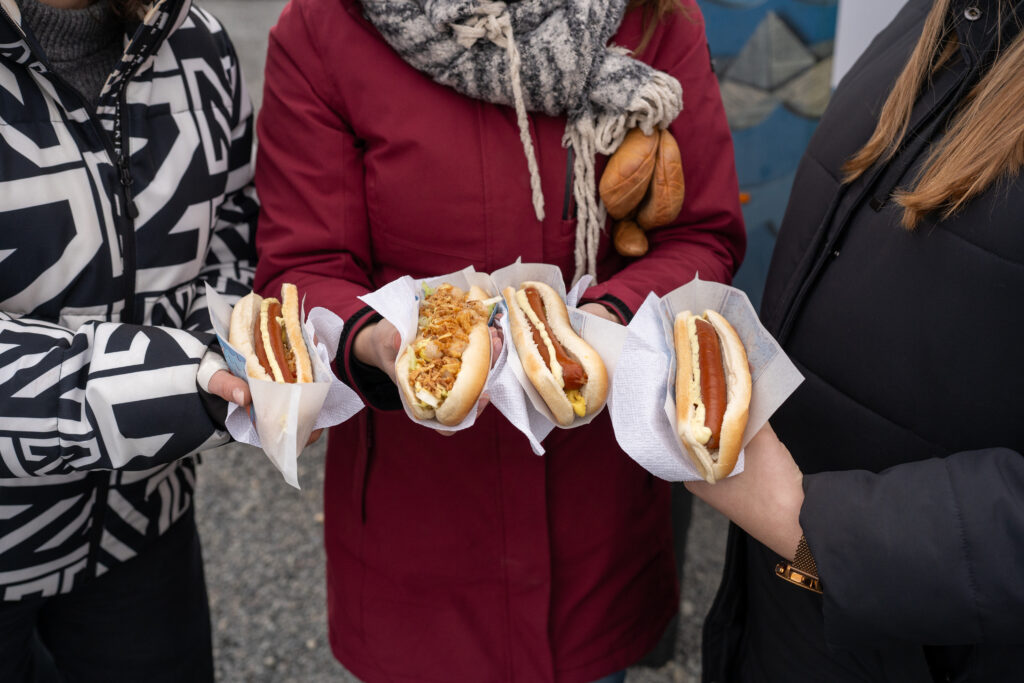
Food: Want to eat something? Restaurants with cuisine from all over the world are located in the capital. Our tip would be to visit the small bakery BakaBaka.
Accommodation: Hotel Viking.
Day 2
Starting the roadtrip strong our journey would go from the Reykjavik area to famous Golden Circle views. The Golden Circle is the most famous of all scenic routes in Iceland and combines stunning landmarks and historically significant places in a circular sightseeing tour. The Golden Circle is a collective name for the route and the sights. The distance is appr. 250 km from and to Reykjavík and depending on how much you want to see, the route can take from 1 to 3 days.
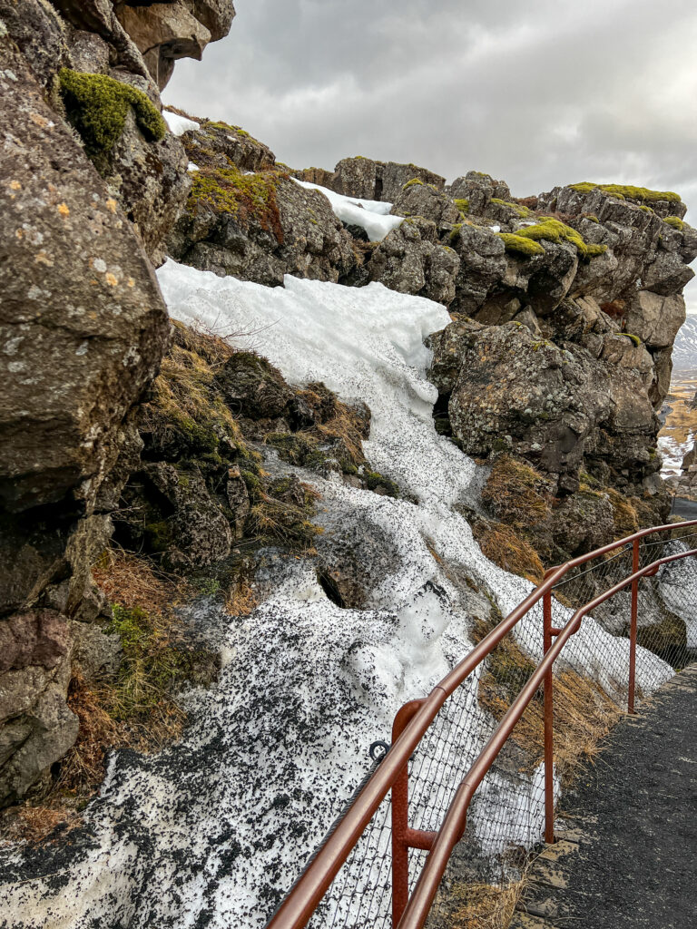
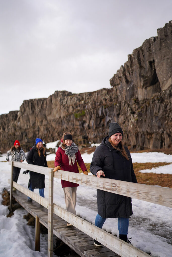
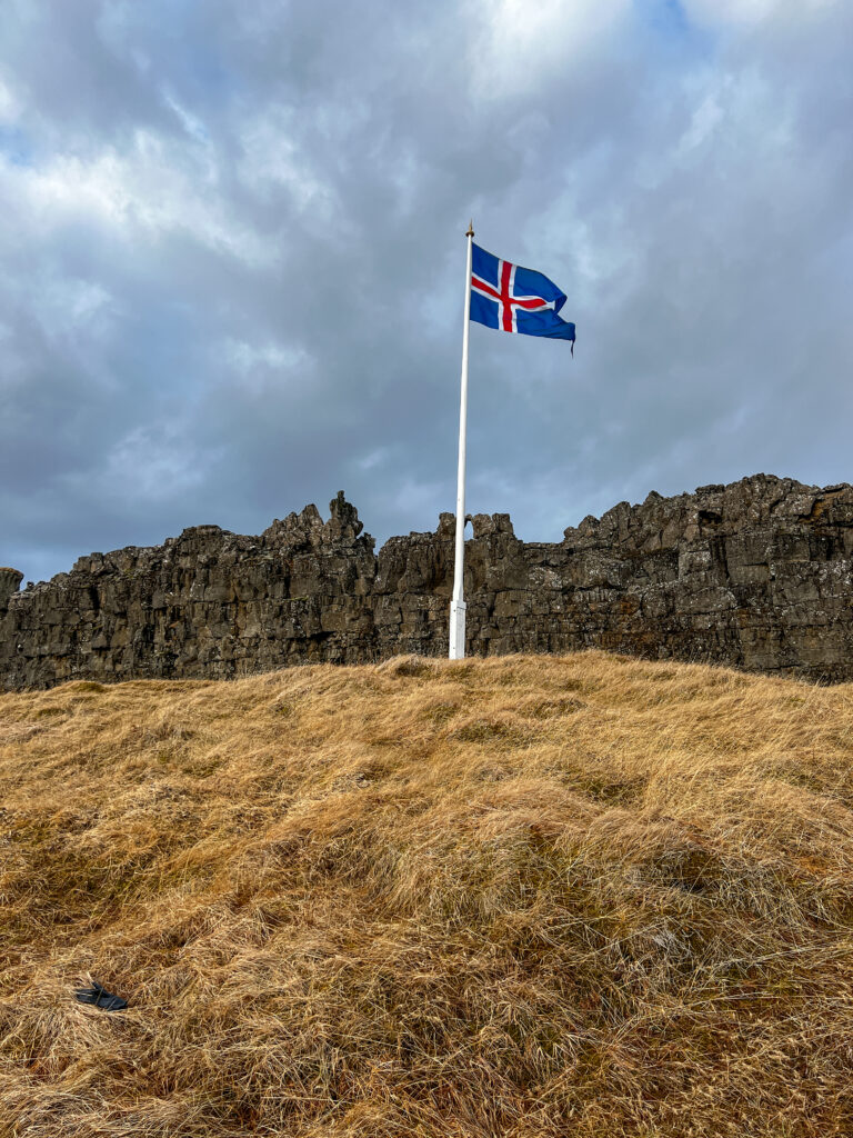
Thingvellir National Park
Our trip along the Golden Circle was clockwise, starting at Thingvellir National Park (Þingvellir). Þingvellir is the historical and geological treasure of Iceland, wrapped in scenic beauty. Iceland proclaimed its independence from Denmark at this significant place. Since 2004, Þingvellir is a UNESCO World Heritage site. In Þingvellir, the tectonic plates drift apart, the crevasses being visible in Almannagjá canyon as well as in Silfra, where it is possible to dive and snorkel between the continents. The biggest natural lake in Iceland, Þingvallavatn, and the Öxaráfoss waterfall add to the scenic beauty of Þingvellir National Park.
Parking: There are multiple parking lots at the Thingvellir National Park (P1 – P5). P1 is the first one you will encounter if you travel from Reykjavik and is the closest one to the Visitor Center. The other parking lots are a bit further and are closer to the waterfalls instead of the Almannagjá (ravine).


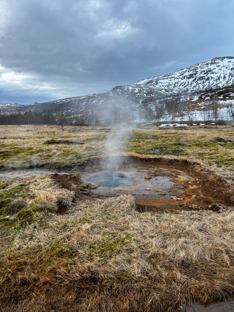
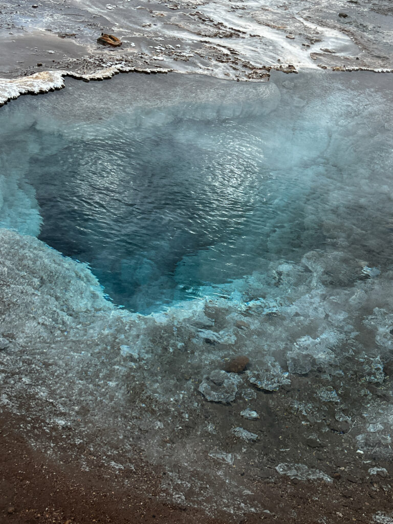
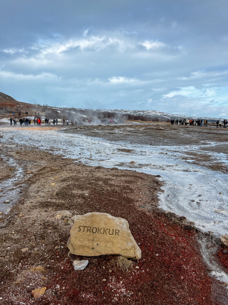
Geysir
From there we continued the route up to Geysir. The Geysir geothermal area is a hot-spring paradise in Haukadalur valley. The area is most famous for being the home of the geyser from which all other geysers derive their name: Geysir. Though Geysir itself is currently in a phase of inactivity, its neighbor Strokkur more than makes up for it. Every five to ten minutes, it bursts a column of boiling water to heights that can reach over 130 feet (40 meters). The surrounding area is dotted with various fumaroles, hot springs, and mud pits.
Brúarfoss
On the way to the Gysers is the waterfall Brúarfoss. Brúarfoss means “bridge waterfall,” named for a stone archway that once crossed the river. That arch fell hundreds of years ago, but the name remains the same. The waterfall is fed by the Brúará River, which is glacier melt from Langjökull glacier. This glacial water is what gives Brúarfoss its sky blue color.
Parking: There are two parking lots for Brúarfoss waterfall. Since April 2023, there is a new parking lot for Brúarfoss. From this parking lot, it is only a 5 minute walk to get to BrúarfossIf. Otherwise you can park at the Brúarfoss Trail – Parking lot, it is 3.5 km (2.2 miles) one-way to get to Brúarfoss. It takes roughly one hour to walk to the Brúarfoss waterfall.
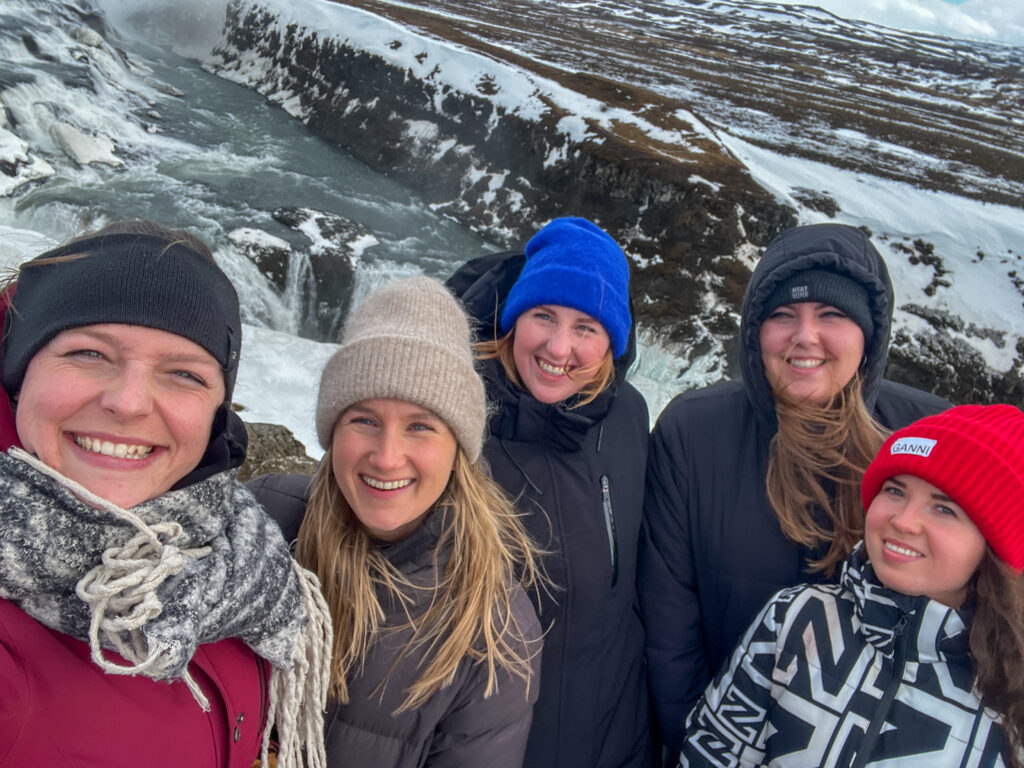
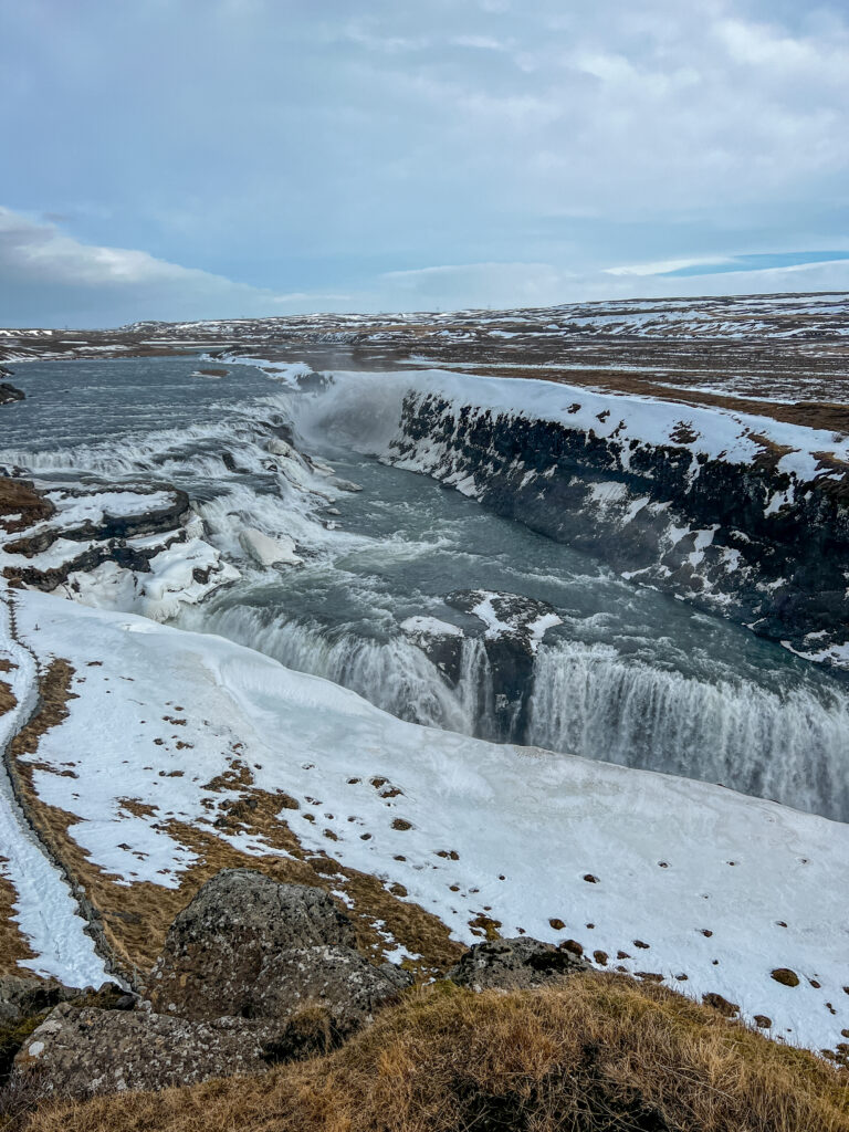
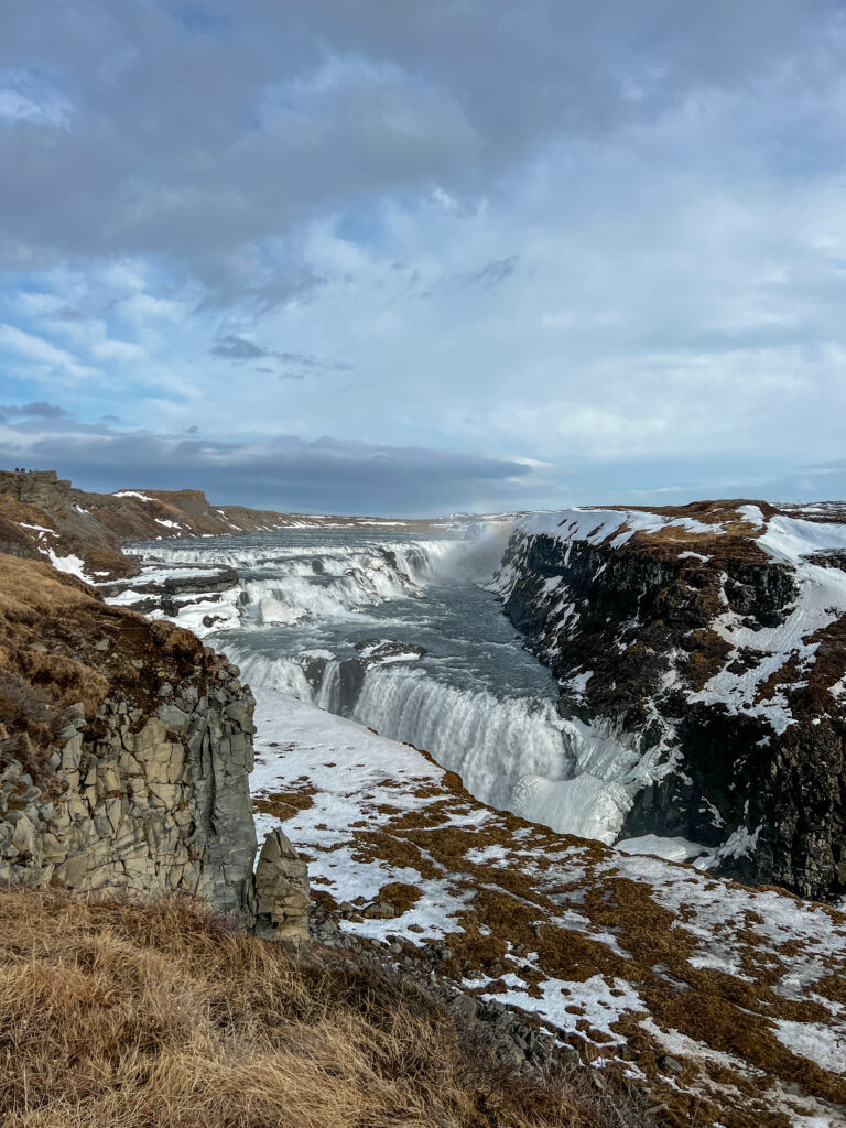
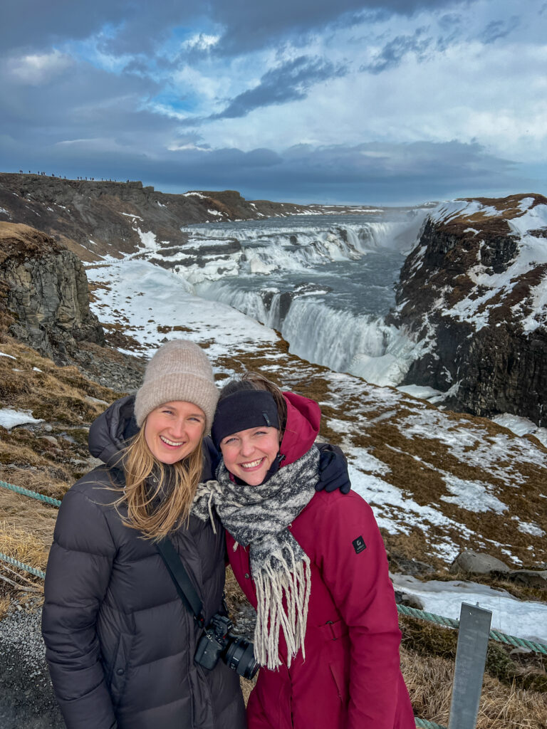
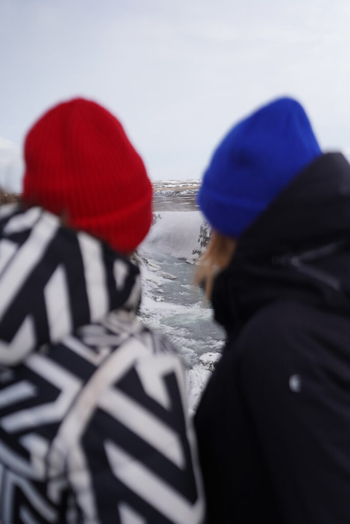
Gullfoss
The ‘Golden Falls’, Gullfoss, is one of the most beautiful and powerful waterfalls in Iceland, plummeting 105 feet (32 meters) in two tiers into the river gorge of the popular rafting river Hvita.

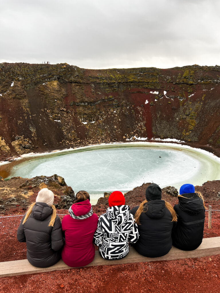
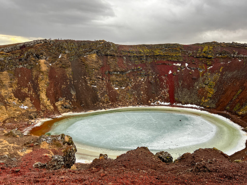
Kerid Crater
The last stop of the day was the Kerid Crater. Kerid Crater is a Scoria Crater. In its present form the crater was probably formed by a small magma chamber under the crater being emptied by an eruption. The water in the crater doesn’t drain out but rises and falls according to the water table. It is a representation of the groundwater level.
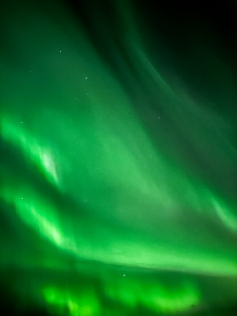
Northern Lights
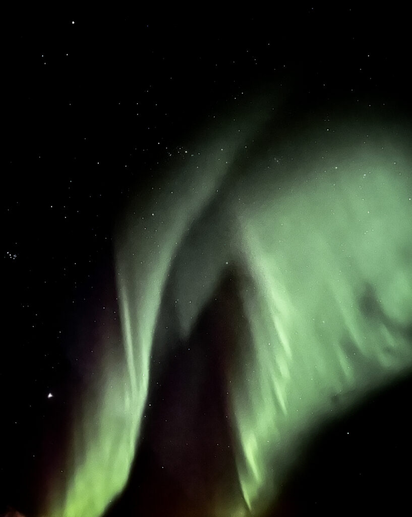
As cherry on top of an amazing day, we had the luck to see the Northern Lights! The Northern Lights can be seen when there are little to no clouds and your surroundings are dark. Seeing the Northern Lights in a city full of light pollution is way harder then when you are in the middle of nowhere. Tip: Download the Aurora app. The app gives you insight into the changes you have to see the Northern Lights.
Accommodations: BSG Apartments.
Day 3
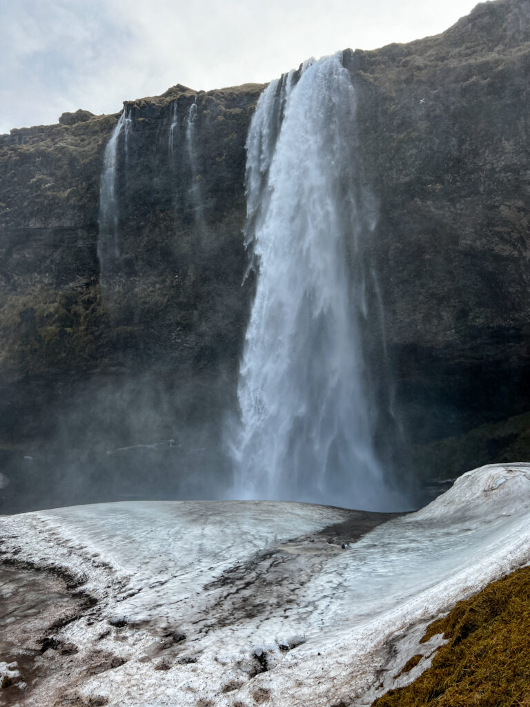
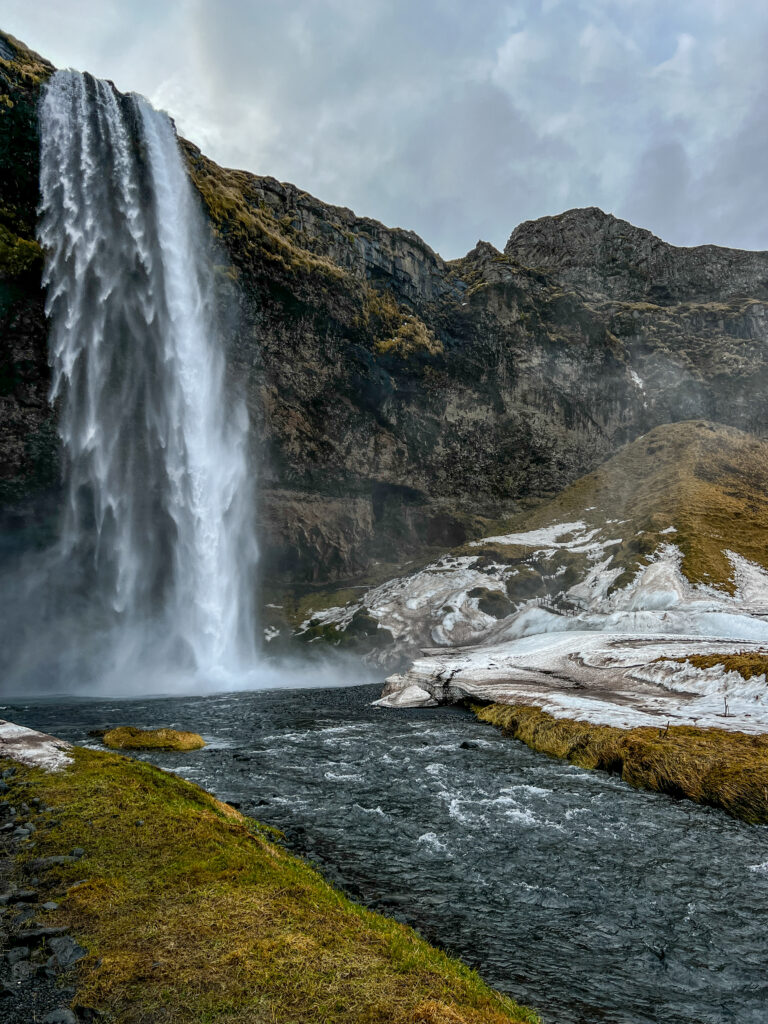
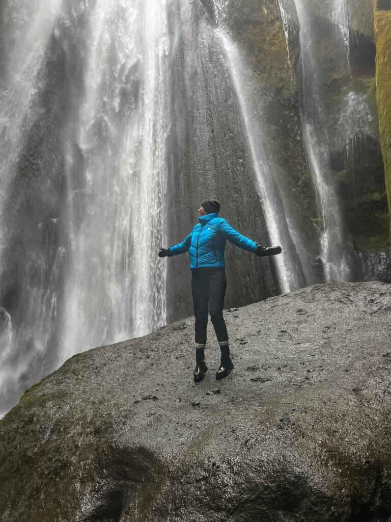
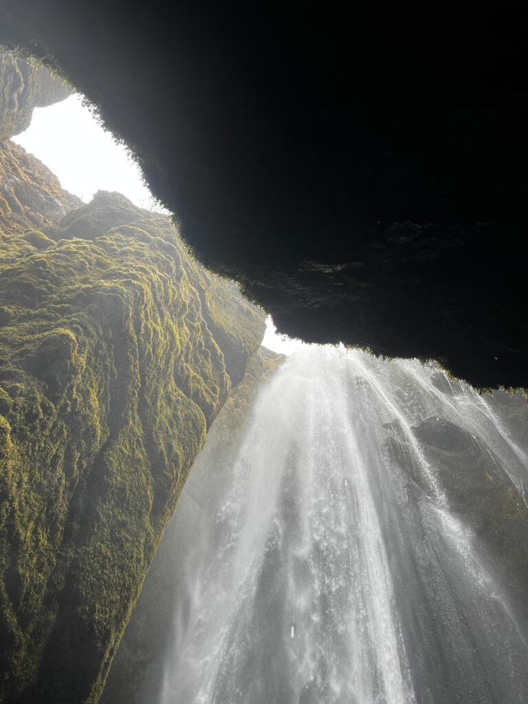
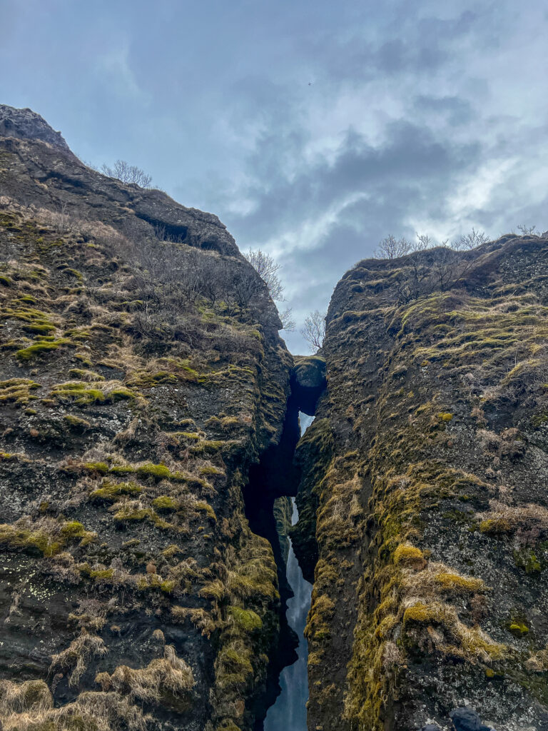
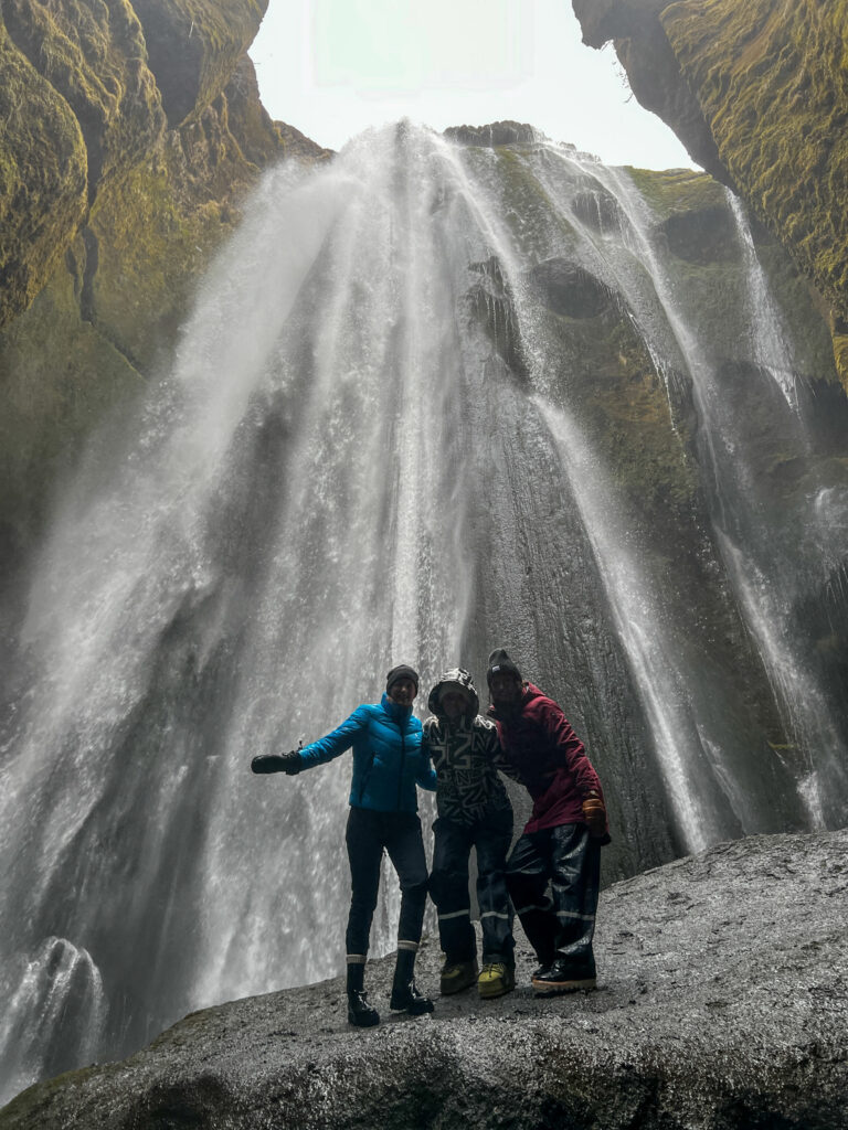
Seljalandsfoss and Gljufrabu
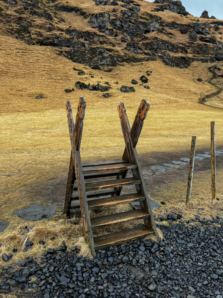
New day, new waterfalls to chase. This day would be getting wet since we were visiting the waterfalls Seljalandsfoss and Gljufrabui in the Rangárping area. The waterfall Seljalandsfoss is part of the river Seljalandsá, has its origins underneath the glacier Eyjafjallajökull. The volcano beneath this ice cap was the one that erupted in 2010 and caused havoc at airports across Europe. The most distinguishing feature of Seljalandsfoss is a pathway that stretches around it. The cliffs behind the falls have a wide cavern, and rocks and paths allow guests to fully encircle it in summer. Unfortunately we couldn’t walk around the waterfall when we visited because of the snow.
Because of its ‘hiding place’, Gljúfrabúi is overlooked by most travellers, even though thousands of people visit Seljalandsfoss, less than a kilometre away, every day. Gljúfurá, runs through a cleft in the cliff, and if you wish to approach the falls you need to go through these waters. Tip: Pack water resistant clothing if you want to get close to the waterfalls. You can walk behind Seljalandsfoss and go into the cave of Gljufrabui. The splashing water and the wind ensure that you can get really wet.
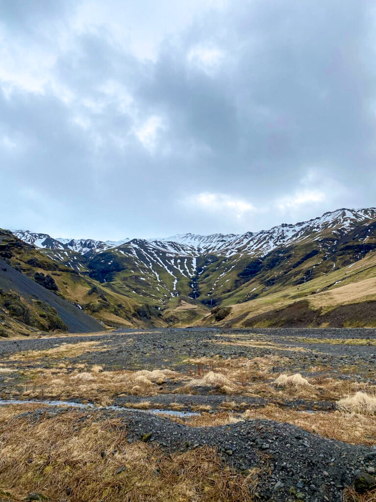
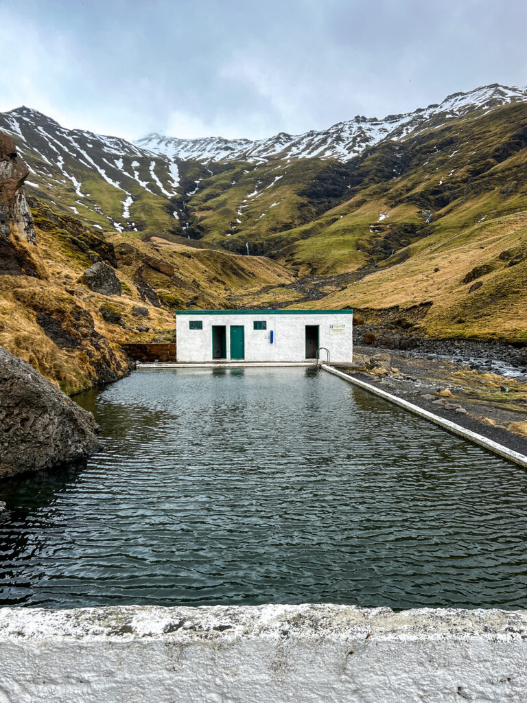
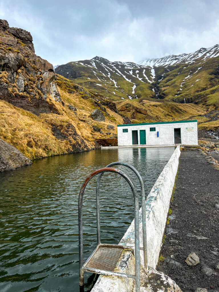
Seljavallalaug bílastæð
Just a few minutes further is the Seljavallalaug bílastæði. This area is known for the Seljavallalaug Swimming Pool. A swimming pool that is the oldest in Iceland. It was built in 1923 by a local man and the purpose was to teach the Icelandic people how to swim! You can still swim in the pool, so if you want to take a dip bring your swimming gear.
Good to know about the Seljavallalaug Swimming Pool is that it is not a hot spring. The temperature will be pleasant but is not more than 30 degrees Celsius. While Seljavallalaug may look magical, it isn’t without its problems and we want you to know what you are getting into upfront so you can make the choice to go or skip it in lieu of doing something else.
- The distance to the pool is around 2 km round trip and takes around 20 minutes each way, depending on how fast you are. The hike to Seljavallalaug Pool is flat the whole time, but it goes along a very rocky river bed so you have to walk slowly so as not to twist your ankle. The walk alone to the pool is worth it, since it is in a valley between the mountains.
- The changing rooms at Seljavallalaug Pool are realy dirty. There are piles of garbage and wet clothing that people left behind. The changing rooms are only cleaned once per year and it shows. Back before the tourism boom, local people would come together to maintain the place but now that doesn’t happen anymore, and really, what is the point when tourists will go destroy their hard work because garbabage is left behind on a daily basis.
Accommodations: Hörgsland Cottages.
Day 4
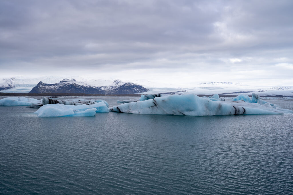
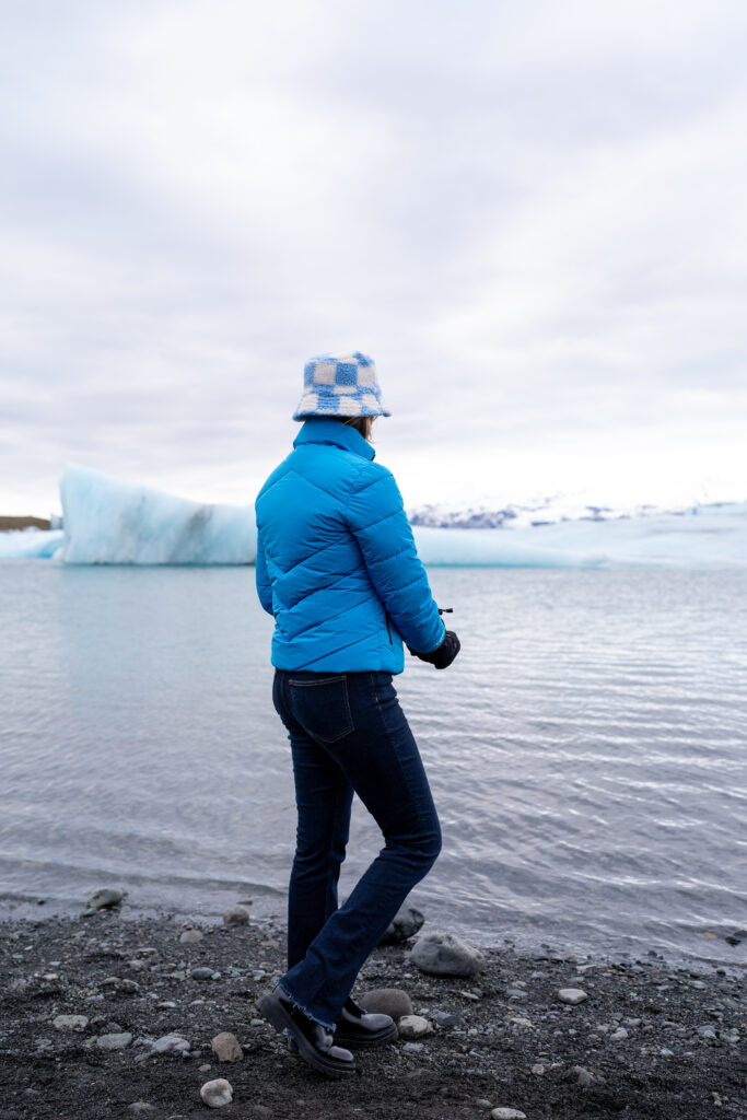
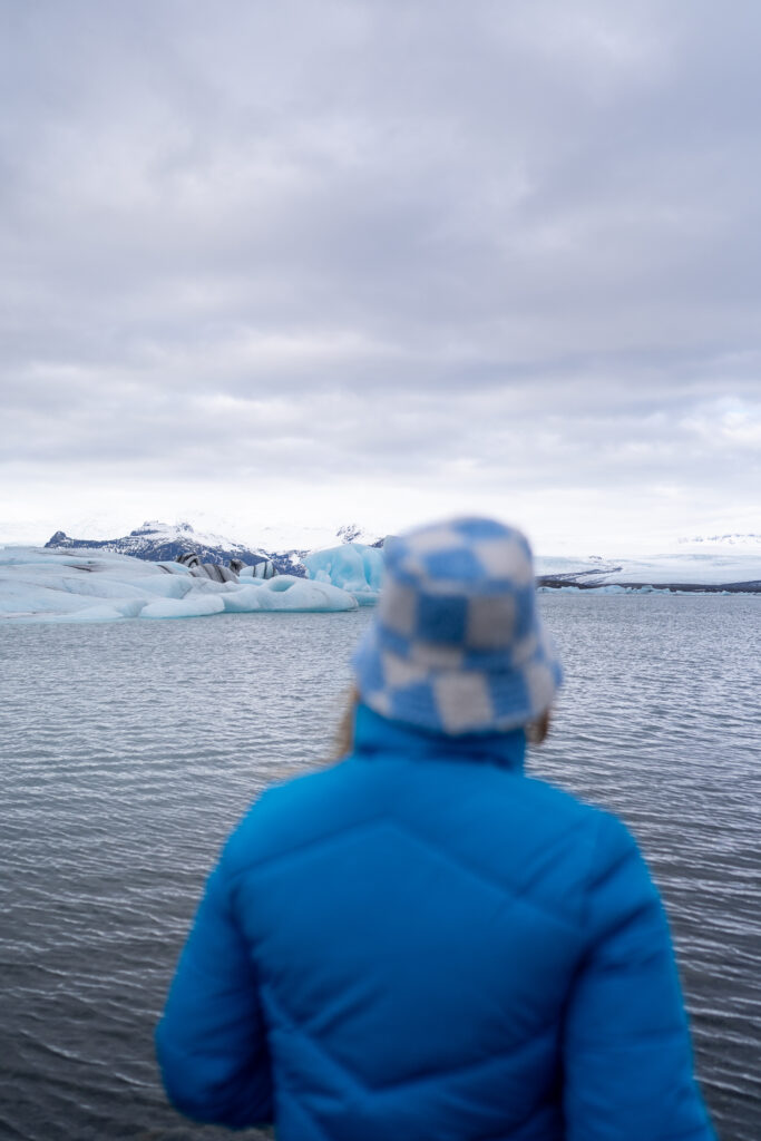
Jökulsárlón
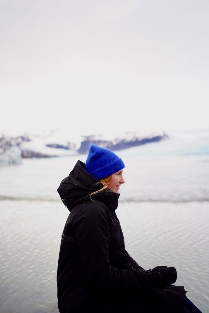
Jökulsárlón or also the glacial river lagoon is a large glacier lake part of Vatnajökull National Park and at the bottum of the Breiðamerkurjökull glacier. The lake developed only about 70 years ago (1948 is mentioned). The Breiðamerkurjökull glacier has been melting since then it developed into a lake after the glacier started receding from the edge of the Atlantic Ocean. These icebergs gather at the mouth of the lake’s shallow exit, melt down into smaller ice blocks, and roll out into the sea. Jökulsárlón is the furtest we travelled during our road trip along the southern part of Iceland.
The lagoon is full of wildlife and even from the car parks, you will have amazing encounters. Seals fish in the river and are commonly seen in the winter months lazing on icebergs and hunting in the flowing water. We saw multiple seals playing with eachother will visiting the lagoon.
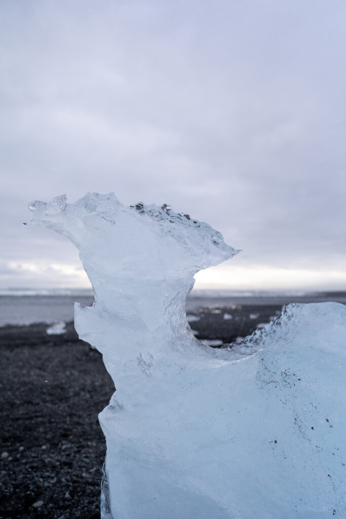
Breiðamerkursandur or Diamond Beach
The Diamond Beach called Breiðamerkursandur is located next to the Jökulsárlón Glacial Lagoon. This beach or also referd to as outwash is filled with ice blocks from the Breiðamerkurjökull Glacier which float down the short Jökulsá á Breiðamerkursandi river and washed onto the black sand beach at the mouth of the river. This black beach is spectacular with an ever-changing collection of ice blocks and is the perfect location for photography.
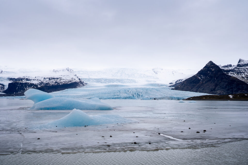
Fjallsárlón
Fjallsárlón is a glacial lagoon in Iceland, located on the southern end of Vatnajökull glacier. The outlet glacier Fjallsjökull, originating from Vatnajökull, extends all the way to the lagoon’s surface, where large icebergs break away from the ice cap and fall into the water below. With the many hundreds of icebergs that float atop the lagoon’s surface, Fjallsárlón is considered to be a strong second to the nearby, and more famous, Jökulsárlón glacial lagoon.
Though smaller than its neighbour, it is less known, thus less crowded with other visitors. It is possible to take boat tours on Fjallsárlón, an excellent way of both seeing the icebergs up close and adding a sense of adventure to the lagoon’s serene tranquillity. You need to walk a bit uphill to visit the Fjallsárlón from the parking lot for about 5 minutes which brings you to the viewpoint. From here it is posible to walk down to the lagoon.
Accommodations: Hörgsland Cottages. The day we stayed at the Hörgsland Cottages we were treated to a beatiful sunset.

Day 5
Close by our accommodations is Stjórnarfoss. It is a smaller waterfall of just 10-15 meters high. There is a possibility that you may have the Stjórnarfoss Waterfall all to yourself as there are not many people around, its natural beauty is preserved and makes a magnificent spot to enjoy the landscape.
Fjaðrárgljúfur
Fjaðrárgljúfur canyon was created by progressive erosion by flowing water from glaciers through the rocks over a long period of time, some say 9000 years ago. Its not difficult to get there because its not far away from the main ring road and the gravel road that leads you up there is in good condition. Once there, you can park the car and walk along the canyon all the way to the top. I sure recommend that hike because the view is constantly changing ending up there with a beautiful waterfall and breathtaking view. Well, the canyon does not quite end there but it’s a good place to end your walk and simply enjoy the majestic view in all directions with the sound of the water.
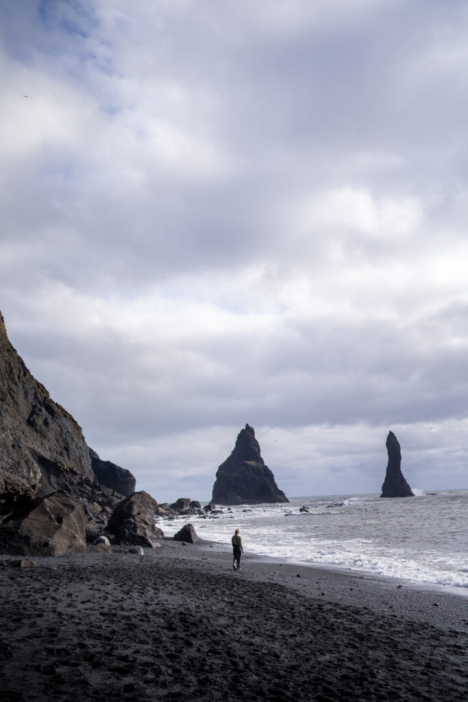
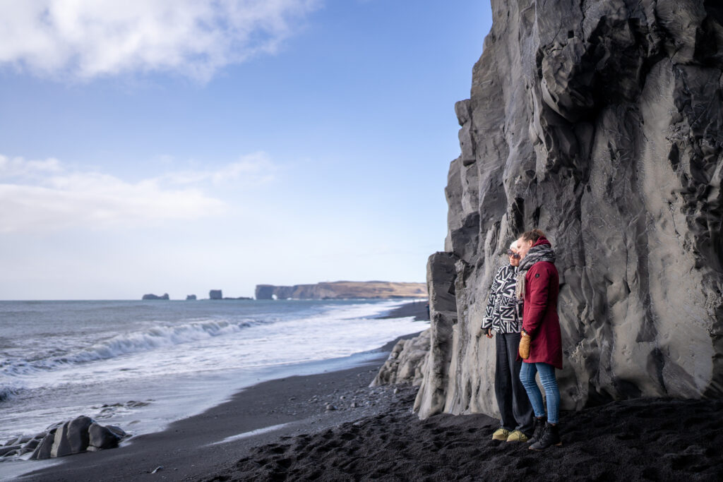
Reynisfjara
Reynisfjara or better known as the world-famous black-sand beach is one of the most beautiful beaches of Iceland. What sets Reynisfjara apart from all the rest are its black volcanic sands, smooth pebbles, unique rock formations, overall moody atmosphere and—more on this below—huge waves crashing on the shore.
From the beach you have a view to the Reynisdrangar sea stacks. These bizarre looking rock pillars are said to be petrified trolls that were caught outside at sunrise and frozen in time, but some strongly believe that they’re actually basalt columns that were once part of the extensive shoreline cliffs that remained standing while other parts were battered down by the ocean.
While being one of the most beautiful beaches, the waves at Reynisfjara can be potentially dangerous. The roaring waves of Reynisfjara often push further up the beach than many would expect. These are called sneaker waves, and they can appear when least expected, even on incredibly still days. There are no significant landmasses in between Antarctica and the shores of Reynisfjara, meaning waves have thousands of kilometers to build. Other dangers in Reynisfjara are from rockfall and rockslides. The cliffs above the Eastern part of the Reynisfjara beach are steep and unstable, so rockfall is common.
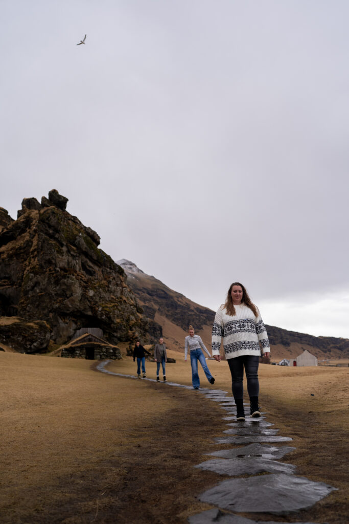
Hálsanefshellir
If the sea allows it you can stroll along the black sand and Hálsanefshellir Cave unveils itself, inviting you to embark on an unforgettable adventure.The cave was formed by the relentless pounding of the Atlantic Ocean against the towering cliffs of Reynisfjara beach. Reynisfjara and Hálsanefshellir are located conveniently in the middle of the South Coast, adjacent to the charming village of Vik.

Restaurant tip: Eat some delicious pizza at Black Crust Pizzerias when you are visiting Reynisfjara. The signature of this pizzeria is the charcoal-infused dough that gives the pizza a striking black color, hence the name of the restaurant!
Wrecked DC-3 Plane
The aircraft, a Douglas R4D-8, a Super DC-3, was originally in possession of the US Navy and considered to be a symbol of the golden age of air travel. No one is quite sure why the plane crashed, with several theories flying about. It is not expected that the plane wreck will be there forever. Sólheimasandur is a glacial outwash plain, meaning when there is an eruption underneath the glacier Mýrdalsjökull, there is a chance floodwater could wash it away.
If you are looking to visit the DC Plane Wreck, you could join organised hiking, horse riding or ATV riding tour that take you right up to the site. Alternatively, you could choose to find the wreckage yourself. To reach it requires a walk (4 km one way) or take the shuttle bus out to the plane wreck (€20,00 one way). We dicided to skip visiting the wreck since the weather was rainy and there was a lot of wind, but if the wather conditions are better this would be a nice addition to the activities of the day.
Accommodations: Sólheimahjáleiga Guesthouse.
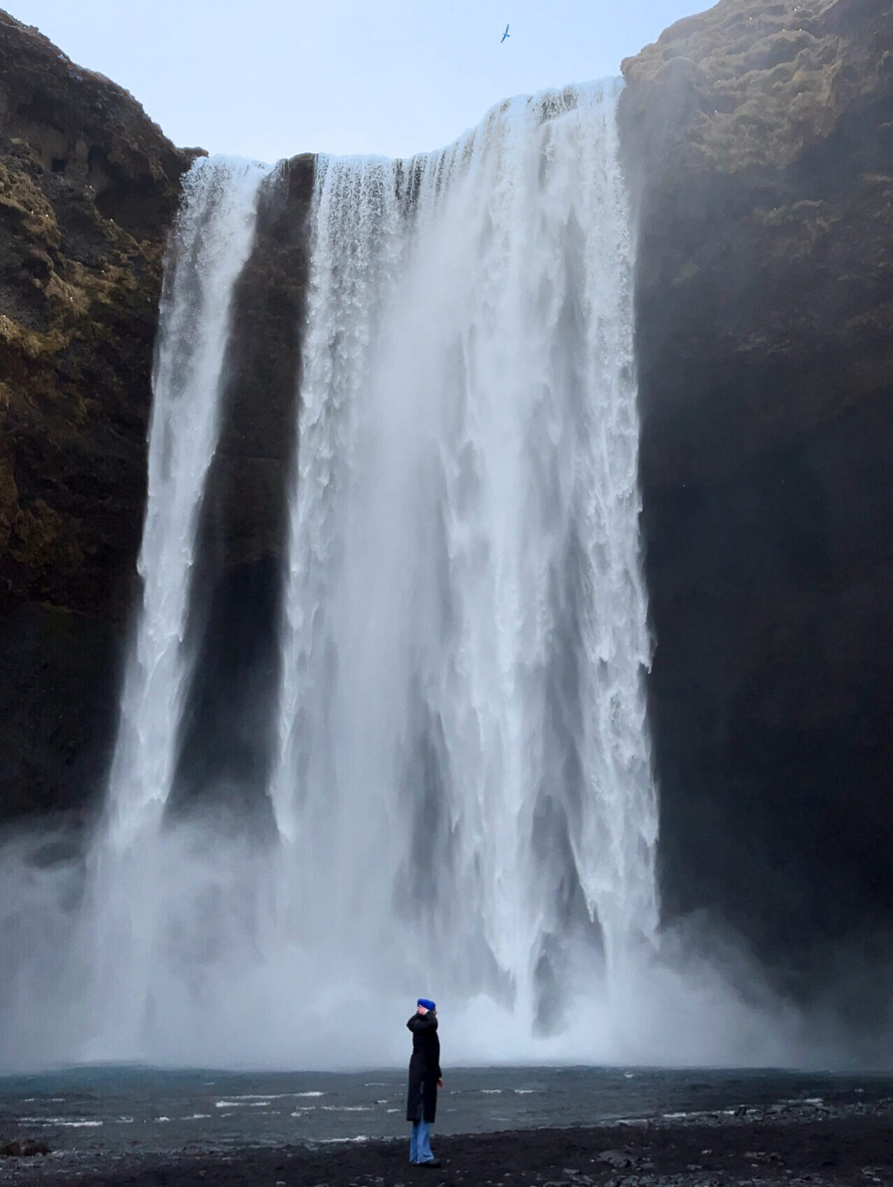
Day 6
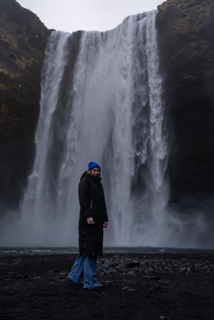
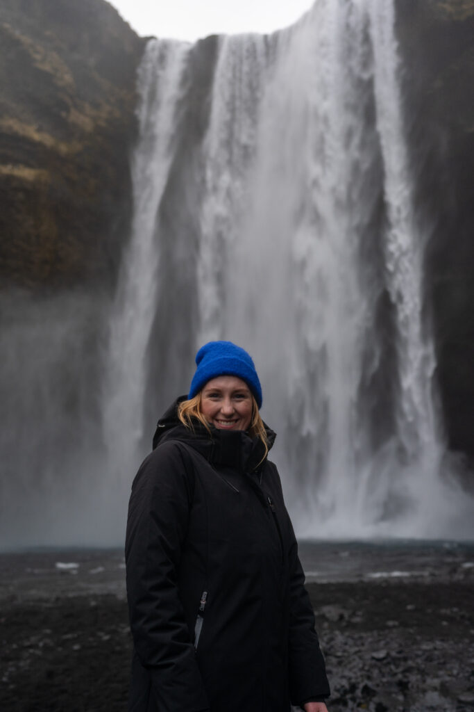
The Skógá, a river, features dozens of waterfalls as it cascades down from the saddle between the Eyjafjallajökull and Katla volcanoes where it originates. The to we visited are Skógafoss and Hestavaðsfoss.
Skógafoss
The start of the journey for many peaple upstream of the Skógá river is Skógafoss one of the biggest waterfalls in Iceland, with a drop of some 60 meters and a width of 25 meters. You can walk right up to it but be prepared to be drenched. It is overwhelming standing next to it. This waterfall can also be admired from above by taking the walking path of 390 steps (we counted them) to the viewpoint.


Hestavaðsfoss
Hestavaðsfoss is officialy the first of these waterfalls upstream the Skógá river and is found just 200 meters above Skógafoss. Here the river falls across a broad shelf of volcanic bedrock and cascades 28 feet in a two-stepped fall. A large chunk of rock divides the river immediately at the base of the falls and in doing so partially obstructs the view of the falls from the trail, but as it is so close to the waterfall itself there really isn’t any way to circumvent the obstruction.
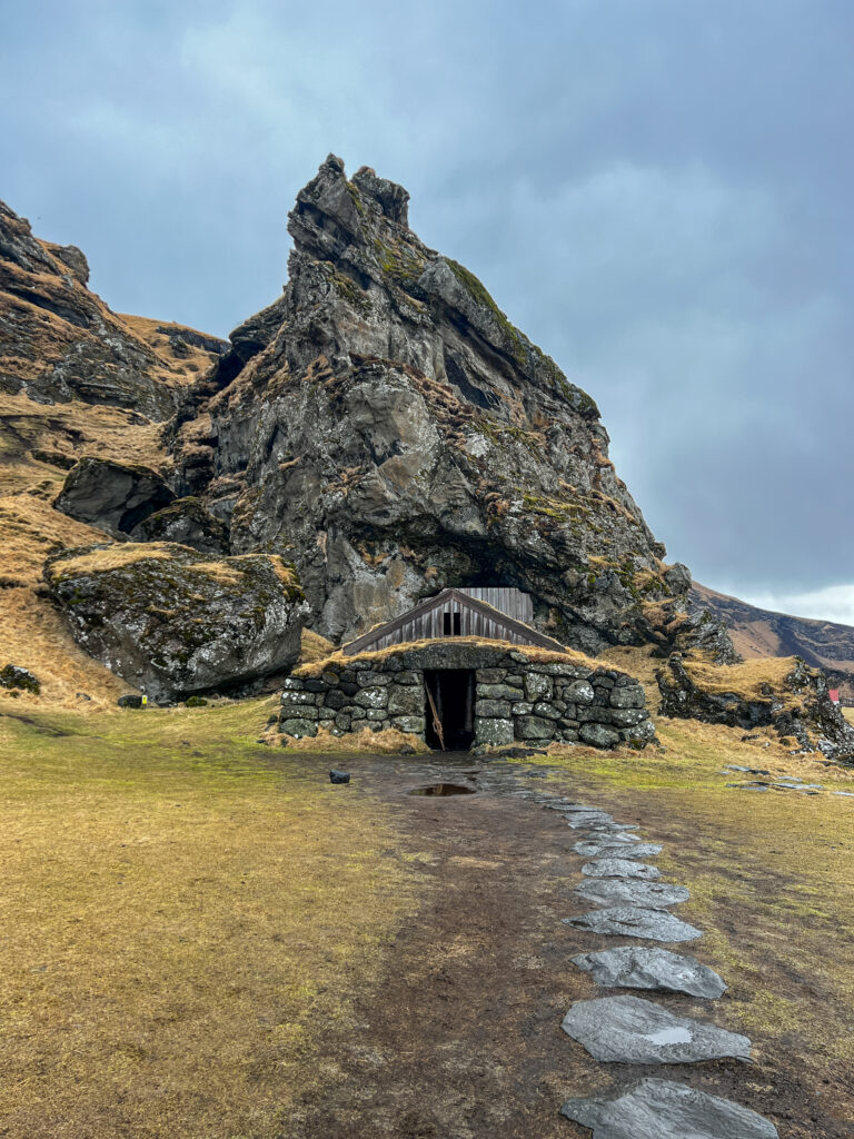
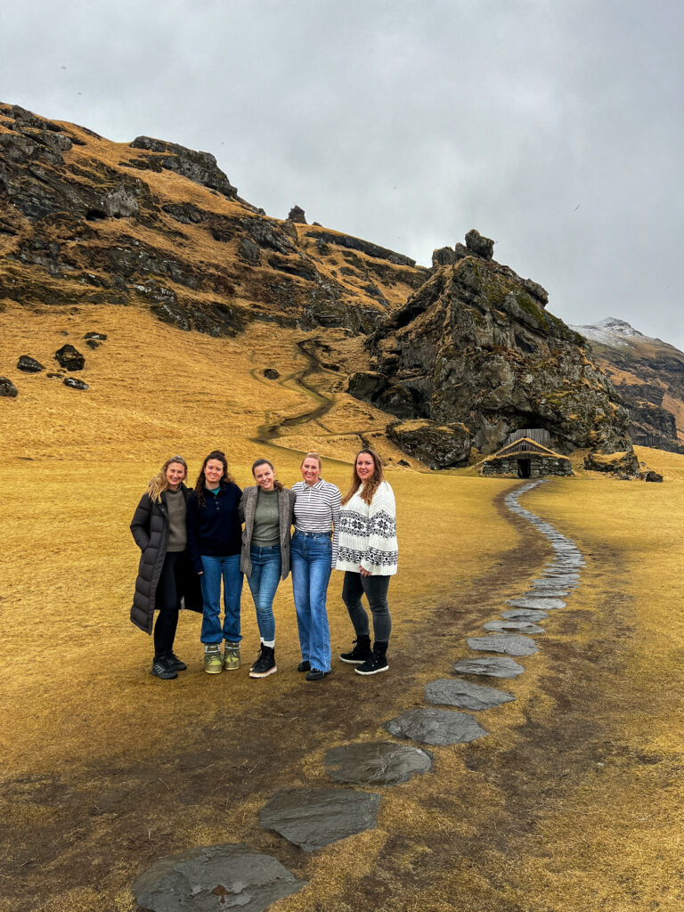
Rutshellir Caves
Rutshellir cave, also known as the Cave of Rutur, is one of the largest man-made caves in Iceland, famous for its mysterious origin and folklore. An enormous pillar of rugged rock serves as the exterior of the cave. This boulder is covered by the same mosses and grasses swarming the mountain. For some tourists, the cave’s outer appearance resembles a turf house, the Icelandic native housing style. Meanwhile, the only entrance to the cave doesn’t fall short of the boulder’s beauty. In particular, a stone barn or sheepcote serves as the gateway to the cave. According to observations, the sheepcote has been rebuilt a few times since 1917. This attraction is easy to get to, especially for tourists going to or coming from Skogafoss waterfall.
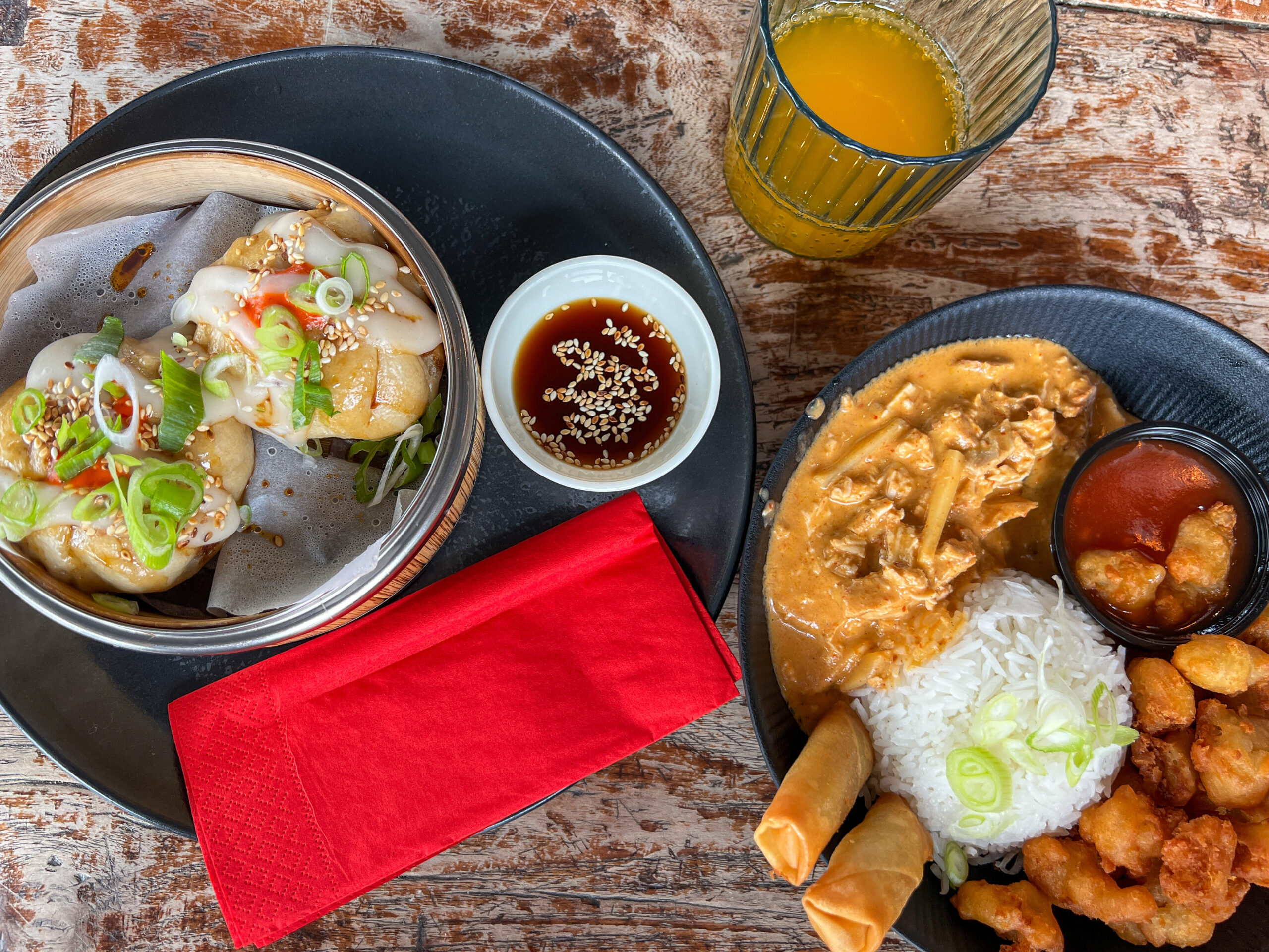
Restaurant tip: The Old Dairy is a food hall in the town of Selfoss. The food hall offers a variety of restaurants to choose from with cuisines from all over the world and focus on local ingredients. Menam Dim Sum serves amazing Chinese dumplings and Dim Sum.
Accommodations: Konvin Hotel – Keflavik Airport.
Day 7
Blue Lagoon
The Blue Lagoon is one of Iceland’s most famous sights or experiences. Iceland’s most famous hot spring has been a luxury spa complex since 1992 and is located in a beautiful area in the middle of a lava field. The spa is located in a lava field 5 km from Grindavík and in front of Mount Þorbjörn on the Reykjanes Peninsula, in a location favorable for geothermal power, and is supplied by water used in the nearby Svartsengi geothermal power station. The water’s milky blue hue is due to its high silica content. The silica forms soft white mud on the bottom of the lake which bathers rub on themselves.The water is also rich in salts and algae. The water temperature in the bathing and swimming area of the lagoon averages 37–39 °C.
Lava eruptions
A series of four lava fissure eruptions commenced on December 18, 2023, at the Sundhnúkur crater chain, north of Grindavík. The eruptions occurred within the Reykjanes volcanic zone.
- The first eruption started on December 18, 2023, and lasted 3 days until December 21.
- The second eruption began on January 14, 2024, and ended on January 16. Within 24 hours, lava reached the outskirts of the town, damaging property and forcing people to evacuate.
- The third eruption began on February 8, 2024, about a kilometer north of Grindavík. Producing lava fountains up to 80 m (260 ft) tall. The eruption ended later in the day, with an estimated 15 million cubic meters of lava erupted.
- The fourth eruption started on March 16, 2024, in the same area as the February eruption and, as of April, is still ongoing. Despite the initial intensity, the eruption marks the longest of the four since December 2023.
The eruption is not considered dangerous to the public or flights. If the fissure eruption only affects the area directly surrounding the eruption site with lava flows and if the authorities allow it, people can approach the site. While we were driving to the Blue Lagoon, we had the amazing experience to see some of the cooled of lave flow.

Accommodations: Konvin Hotel – Keflavik Airport.